Historical survey maps of Rochford (courtesy of Roy Hilton & Sorrell's)

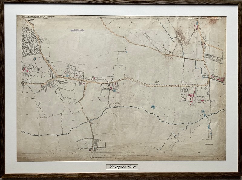
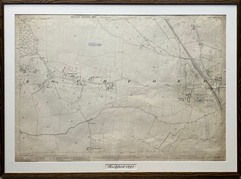
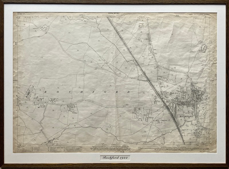
H. V. & G. Sorrell have undertaken the surveys of this area for many years. Roy Hilton has kindly donated some of these historical survey maps to Rochford Town Team.

There are 3 of Rochford, dated 1873, 1897 and 1922. The first two cover the area from The Lawns to Rochford Hall and the Almshouses, showing the area pre and post the railway. The 3rd is a bit more to the East and includes Rochford town centre. 

They have now been framed and are each approximately 115cm x 84 cm. They can be either free standing on a table (using an attached back support) or can be hung on the wall. 
 
These will be on display from time-to-time. If any organisations are interested in displaying them, then please contact the Town Team at https://www.rochfordtown.com/contact-us/ or info@rochfordtown.com 
 
Framing of these maps was funded by Rochford District Council and the UK Government using an allocation from the UK Shared Prosperity Fund.
Back to Memory Lane