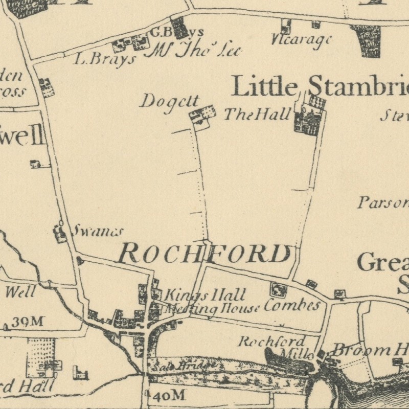
How did the County of Essex look in 1777, when Rochford was a focal point and Southend was simply the South End of Prittlewell?
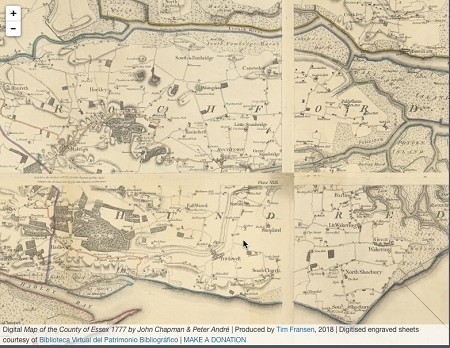
In association with the Essex Record Office (ERO), Tim Fransen has developed this open access high-resolution interactive version of the Chapman and André's Map of Essex 1777 using digitised plates from the ERO publication No.11, 1950. To extend the ERO publication’s original intention 'to enable a wide public to enjoy this remarkable map' this online version supports all modern web browsers, platforms and devices for the benefit of students, teachers, historians, researchers and other interested people.
Visit http://map-of-essex.uk for fullscreen version.
Similar to Google Maps, on a computer, you can zoom in and out by using the + and - buttons, by double-clicking or by using your mouse scroll wheel. To move around the map simply click and drag or use your keyboard arrow keys. On a mobile, you can use typical navigation gestures such as press and drag to move around the map and double-tap or pinch and spread to zoom in and out.
Back to Memory Lane